Log in
All resources
Create a design
1,693 Free Artworks of Historic Map
david rumsey historical map collection
maps of paris from the david rumsey historical map collection
atlas map
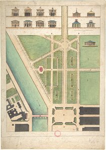
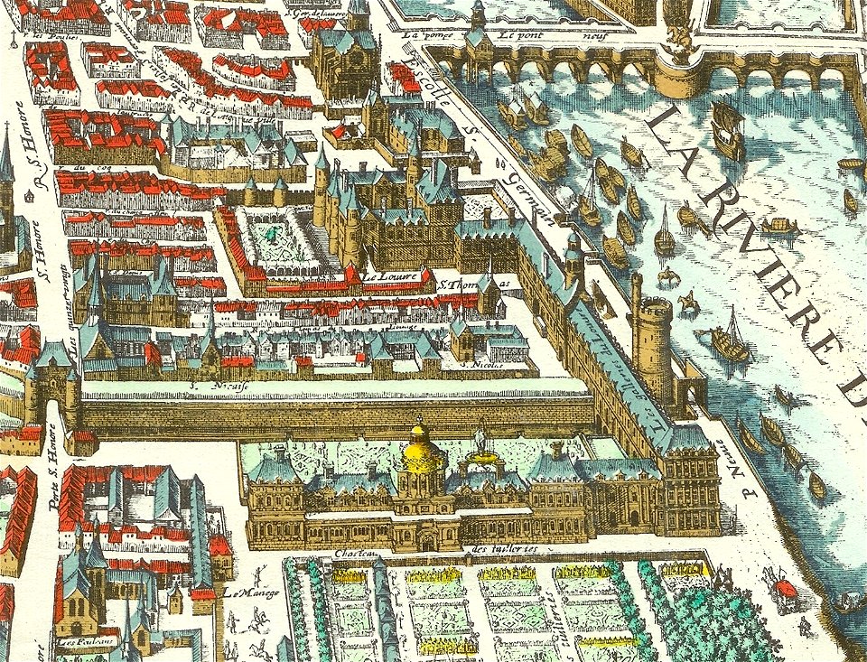
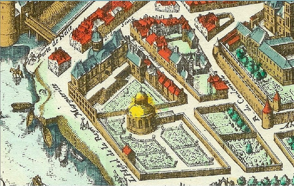
turgot map of paris, david rumsey historical map collection
atlas des anciens plans de paris by imprimerie nationale, 1900 from the david rumsey historical map collection
lithographs of paris
18th-century maps of paris
map of paris by jouvin de rochefort (boutier 112)
baroque
maps with cartouches
images from metropolitan museum of art (paris project)
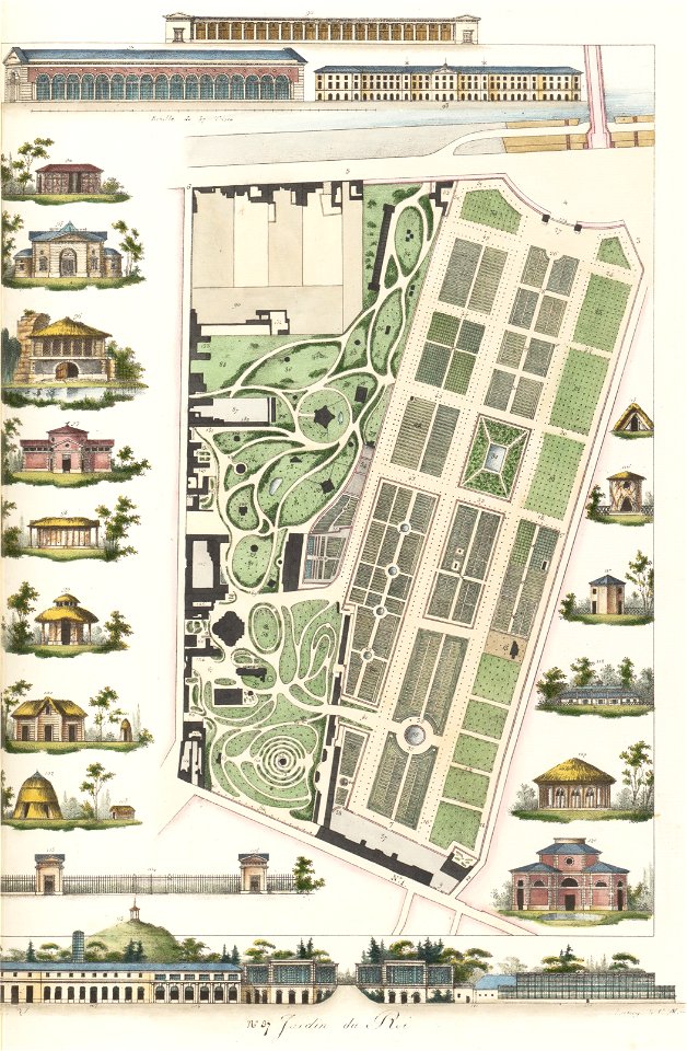
gabriel thouin
historical images of pont neuf
lithographs of paris
historical images of île de ré
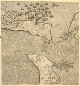
siege of la rochelle
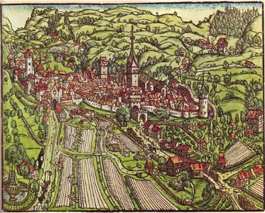
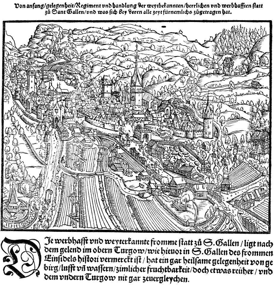
historical images of st. gallen
heinrich vogtherr (i)
ferdinand stadler
1847
historical images of île de ré
siege of la rochelle
images from metropolitan museum of art (paris project)
engravings in the metropolitan museum of art
île de la cité in art
paris
17th-century maps of pomerania
old maps of rügen
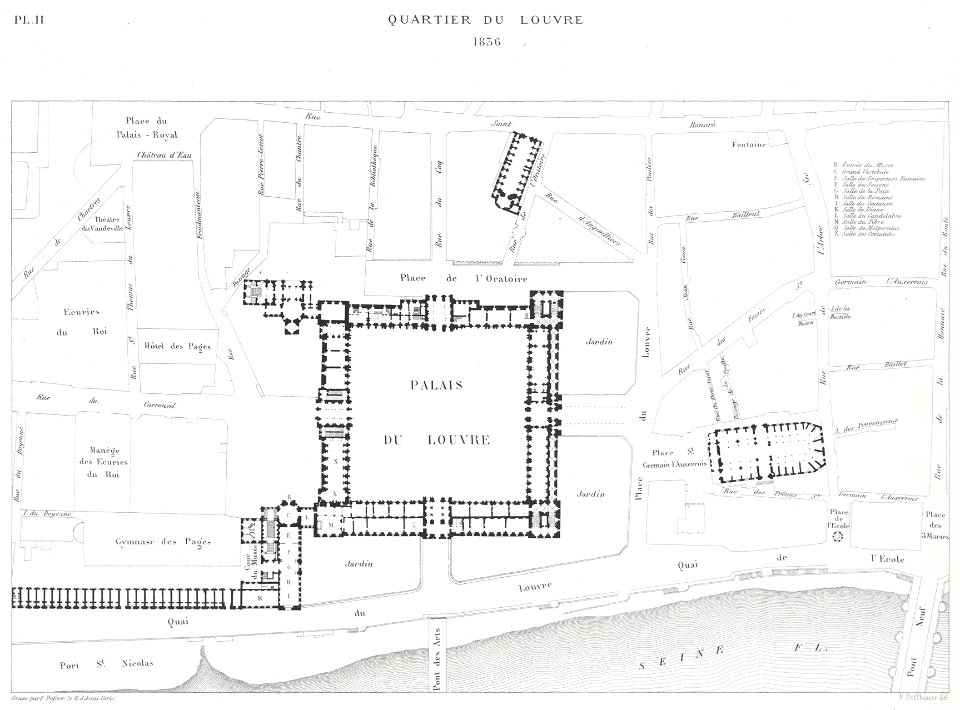
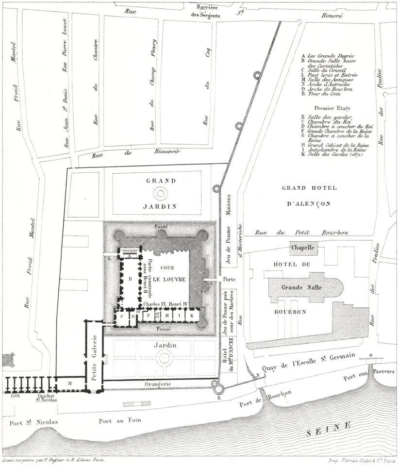
place du louvre (paris)
lithographs of paris
historical images of st. gallen
st gallen
images from metropolitan museum of art (paris project)
gabriel thouin
naval battles involving france
1711
churches in paris on the maps
butte des moulins
paris in the 16th century
lithographs of paris
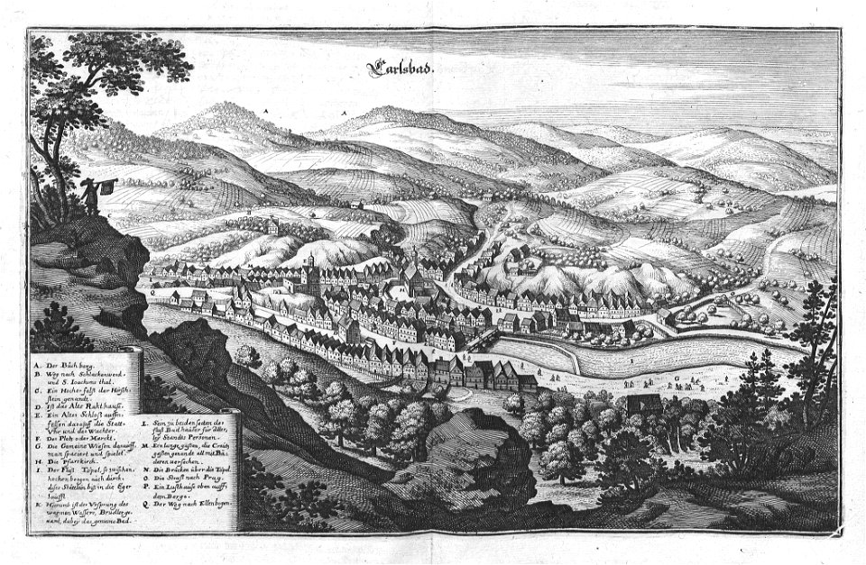
zámecká věž (karlovy vary)
views of karlovy vary
bird's-eye views of paris
1860 in paris
maps and topographical views by joris hoefnagel
hajduks
maps with cartouches
atlas van der hagen
lithographs of paris
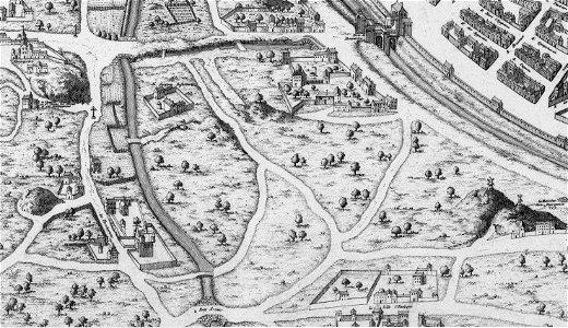
palais de la cité
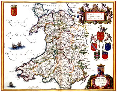
old maps of ireland
ireland
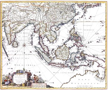
history of indonesia
mataram sultanate
heraklion venetian walls
1651 in candia
historical images of église saint-germain-l'auxerrois
palais du louvre in the 1610s
chapelle de l'école nationale supérieure des beaux-arts
historical views of the seine in paris
maps by jacques-nicolas bellin
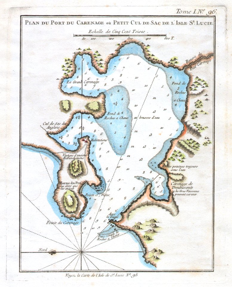
old maps of saint lucia
bird's-eye views of paris
1860 in paris
18th-century maps of greenland
greenland in the 18th century
nouvelle géographie universelle, vol. i
maps showing 19th-century history
1892 in the united states
laredo, texas
nathaniel whittock
skylines of london
17th-century maps of sri lanka
jaffna kingdom
al-andalus
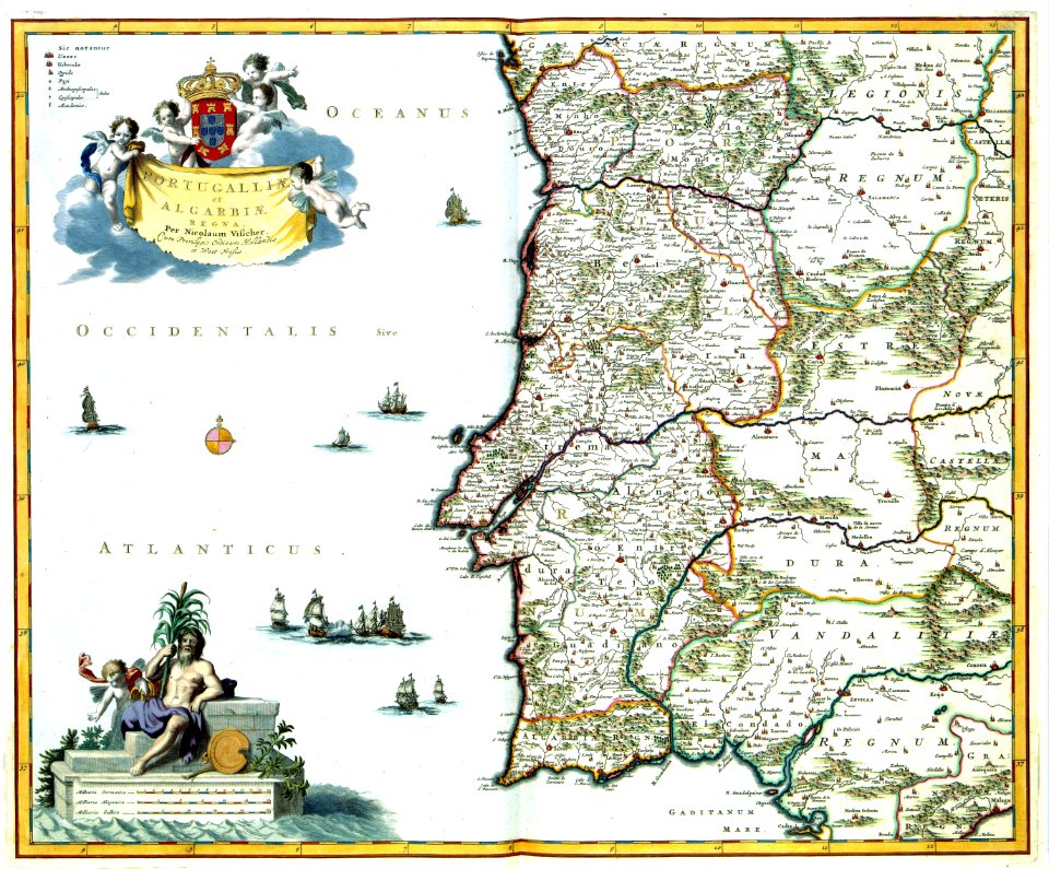
portugal
17th-century maps of estonia
old maps of latvia
human migration
new albion
architectural drawings of luxembourg palace
maps of jardin du luxembourg
ottoman period in the history of palestine
david rumsey historical map collection
1747 maps of north carolina
maps by emanuel bowen
george washington
male
historical images of the jardin du luxembourg
historical images of luxembourg palace
historical images of kollam
kollam port
old maps of the danube in budapest
gerard jollain
old maps of arkansas in the american civil war
julius bien
historical images of parvis notre-dame - place jean-paul ii
turgot map of paris – derivative files
danubius pannonico-mysicus
1726 books
maps by christian sgrothen
inde (river)
maps in civica raccolta delle stampe achille bertarelli (milan)
mdlxxiii (numeral)
maps by thomas kitchin
andrew dury
atlas des anciens plans de paris by imprimerie nationale, 1900 from the david rumsey historical map collection
maps of paris from the david rumsey historical map collection
maps of paris from the david rumsey historical map collection
proletarian literature
atlas des anciens plans de paris by imprimerie nationale, 1900 from the david rumsey historical map collection
maps of paris from the david rumsey historical map collection
atlas des anciens plans de paris by imprimerie nationale, 1900 from the david rumsey historical map collection
maps of paris from the david rumsey historical map collection
atlas des anciens plans de paris by imprimerie nationale, 1900 from the david rumsey historical map collection
maps of paris from the david rumsey historical map collection
atlas des anciens plans de paris by imprimerie nationale, 1900 from the david rumsey historical map collection
maps of paris from the david rumsey historical map collection
atlas des anciens plans de paris by imprimerie nationale, 1900 from the david rumsey historical map collection
maps of paris from the david rumsey historical map collection
maps of paris from the david rumsey historical map collection
turgot map of paris, david rumsey historical map collection
historical maps of ethnic groups in romania
nouvelle géographie universelle
maps of paris from the david rumsey historical map collection
baroque
maps of paris from the david rumsey historical map collection
baroque
atlas des anciens plans de paris by imprimerie nationale, 1900 from the david rumsey historical map collection
maps of paris from the david rumsey historical map collection
atlas des anciens plans de paris by imprimerie nationale, 1900 from the david rumsey historical map collection
maps of paris from the david rumsey historical map collection
atlas des anciens plans de paris by imprimerie nationale, 1900 from the david rumsey historical map collection
maps of paris from the david rumsey historical map collection
atlas des anciens plans de paris by imprimerie nationale, 1900 from the david rumsey historical map collection
maps of paris from the david rumsey historical map collection
giovanni camocio
martino rota
atlas des anciens plans de paris by imprimerie nationale, 1900 from the david rumsey historical map collection
maps of paris from the david rumsey historical map collection
atlas des anciens plans de paris by imprimerie nationale, 1900 from the david rumsey historical map collection
maps of paris from the david rumsey historical map collection
maps of paris from the david rumsey historical map collection
baroque
maps of paris from the david rumsey historical map collection
baroque
history of heilbad heiligenstadt
baroque
maps by willem and johannes blaeu
old maps with mercator projection
17th-century maps of pomerania
old maps of rügen
atlas des anciens plans de paris by imprimerie nationale, 1900 from the david rumsey historical map collection
maps of paris from the david rumsey historical map collection
media from the national library of finland
classicism
maps of paris from the david rumsey historical map collection
turgot map of paris, david rumsey historical map collection
maps of paris from the david rumsey historical map collection
turgot map of paris, david rumsey historical map collection
maps of paris from the david rumsey historical map collection
turgot map of paris, david rumsey historical map collection
maps of paris from the david rumsey historical map collection
turgot map of paris, david rumsey historical map collection
maps of paris from the david rumsey historical map collection
turgot map of paris, david rumsey historical map collection
maps of paris from the david rumsey historical map collection
turgot map of paris, david rumsey historical map collection
maps of paris from the david rumsey historical map collection
turgot map of paris, david rumsey historical map collection
maps of paris from the david rumsey historical map collection
turgot map of paris, david rumsey historical map collection
maps of paris from the david rumsey historical map collection
turgot map of paris, david rumsey historical map collection
maps of paris from the david rumsey historical map collection
turgot map of paris, david rumsey historical map collection
maps of paris from the david rumsey historical map collection
turgot map of paris, david rumsey historical map collection
maps of paris from the david rumsey historical map collection
turgot map of paris, david rumsey historical map collection
maps of paris from the david rumsey historical map collection
turgot map of paris, david rumsey historical map collection
maps of paris from the david rumsey historical map collection
turgot map of paris, david rumsey historical map collection
maps of paris from the david rumsey historical map collection
turgot map of paris, david rumsey historical map collection
maps of paris from the david rumsey historical map collection
turgot map of paris, david rumsey historical map collection
maps of paris from the david rumsey historical map collection
turgot map of paris, david rumsey historical map collection
maps of paris from the david rumsey historical map collection
turgot map of paris, david rumsey historical map collection
maps of paris from the david rumsey historical map collection
turgot map of paris, david rumsey historical map collection
maps of paris from the david rumsey historical map collection
turgot map of paris, david rumsey historical map collection
maps of paris from the david rumsey historical map collection
turgot map of paris, david rumsey historical map collection
maps of paris from the david rumsey historical map collection
turgot map of paris, david rumsey historical map collection
maps of paris from the david rumsey historical map collection
turgot map of paris, david rumsey historical map collection
maps of paris from the david rumsey historical map collection
turgot map of paris, david rumsey historical map collection
maps of paris from the david rumsey historical map collection
turgot map of paris, david rumsey historical map collection
maps of paris from the david rumsey historical map collection
turgot map of paris, david rumsey historical map collection
maps of paris from the david rumsey historical map collection
turgot map of paris, david rumsey historical map collection
501 - 600 of 1,693
Next page
/ 17